


Ask most visitors what they love about Los Cabos and they’ll talk about the beach. Ask the people who live here and, sooner or later, the trails come up. There’s many great spots within minutes of both Cabo San Lucas and San José del Cabo, and a couple of hikes up north near La Paz that are worth building a day trip around.
Below are the trails we recommend most often. A couple of things apply across the board: the best hiking season runs November through April, and during summer, sunrise starts (or even sunset) are the way to go.
Several of these trails also cross private ranches or community-held land, so expect a small entry fee at some trailheads or a tip for the local guides who keep them open. That money is what keeps these places accessible, so it’s well spent.
Best Hiking in Cabo San Lucas
Mount Solmar
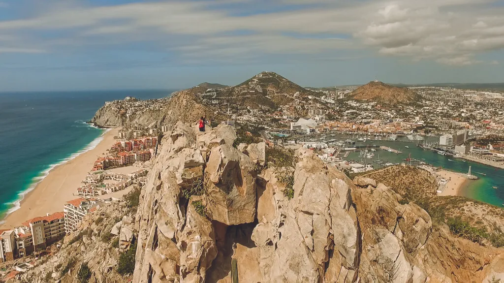
The rocky peak that rises behind downtown, right above Land’s End. It’s short, about half a mile up, but it climbs roughly 400 feet on steep, loose rock, so treat it as a workout rather than a stroll. From the top you look down on El Arco, Lover’s Beach, the marina, and both seas at once. It’s widely considered the best viewpoint in Cabo San Lucas.
One important detail: the trailhead sits on private property, and the hike is done with a local guide named Enrique, who leads group hikes in the mornings, Sunday through Friday. The hike itself is free, but tipping Enrique at the end is customary, and his dogs usually come along on the climb. Go at sunrise and give yourself time at the top.
Cerro de la Z
If you want a solid climb without the scramble, Cerro de la Z is a good option. The route mixes paved road with steeper gravel stretches, so this makes it an easier hike for beginners. Most of the way up you have open views of the city, the marina, and the Sea of Cortez, and the summit gives you the whole picture at once. Locals hike it before work, and most people complete it in a couple of hours. Early morning or late afternoon light is when it’s at its best.
Faro Viejo
Out on the Pacific side, past the Solmar corridor, a route through open dunes leads to the old lighthouse, built in the 1890s and long since retired. It’s a moderate walk, mostly because of the soft sand, and it leads to a quiet stretch of coast that sees far fewer people than the beaches in town. Two notes: there’s zero shade, so go early or go at golden hour, and the Pacific here is not great for swimming. Enjoy it from the sand.
Where to Hike in San José del Cabo

Cerro de las Chivas
‘The” neighborhood hill for San José, on the west side of the city, and the easiest trailhead to reach in town. It’s about a 10 minute drive from downtown, and the trailhead is marked on Google Maps. The main route is roughly two miles out and back with about an hour of hiking: a steady, steep climb with some light rock scrambling near the top, then wide views over the city, the coastline, and the hills inland. Longer routes cross the hill’s three peaks or approach the summit antenna from the back side, adding up to 1,400 feet of gain for those who want a bigger morning.
Practical notes: the hill is crisscrossed with informal paths and there’s no signage, so download a route map before starting. There is very little shade, and dogs are welcome on leash.
The Costa Azul Canyon Trail
This route starts from the Playa Costa Azul parking area, south of the hotel zone, and heads east into the hills behind the coast. The trail climbs through low plateaus to a clear lookout point over the Sea of Cortez, with views up and down the coastline. It’s rocky in stretches but not technical, and it’s close enough to town to finish before breakfast. Like most trails in the area, it’s unmarked, so a downloaded map helps.
The San José Estuary
The freshwater estuary at the east end of San José is one of the only wetlands in the region, protected since 1944, and the flat paths around it are the easiest outing on this list. It’s a favorite with birders: herons, egrets, ospreys, and dozens of migratory species pass through, with the best activity in early morning. The paths connect toward the Paseo Malecón San José, so you can extend the walk along the hotel zone if you want more distance. An hour or two covers it, and it works well for groups with mixed fitness levels.

Santiago and the Sierra Foothills
The town of Santiago sits about an hour north of San José del Cabo on Highway 1, past the airport and the Tropic of Cancer monument. The canyons in the foothills behind it hold year-round water, waterfalls, and natural hot springs, and they’re the reason many locals consider this area the best day trip in the municipality. Everything below runs on ejido or ranch land with small entry fees, and roads past the town are mostly unpaved, so a high-clearance vehicle helps, especially after rain.
Sol de Mayo Waterfall (Cañón de la Zorra)
The main event. Rancho Sol de Mayo, just outside Santiago, manages access to Cañón de la Zorra, where a year-round waterfall about 35 feet tall pours into a deep, swimmable pool between granite walls. You pay an entry fee at the ranch gate, then follow a short, steep trail into the canyon, with ropes and railings installed on the trickier sections. It’s about 20 minutes of careful footing down to the water. Bring a swimsuit, water shoes, and food, and plan to stay a while.
The ranch closes the trail when weather makes it unsafe, so if storms have passed through recently, confirm it’s open before making the drive. Weekends are busy with local families; weekday mornings are much quieter.

Santa Rita Hot Springs
Part of the San Jorge Canyon, reached from Santiago on unpaved roads. After paying a small entry fee to the ejido, a short walk leads to a series of freshwater pools mixed with thermal mineral springs, each at a slightly different temperature, so you can pick your spot. If you keep following the path past the pools, you’ll reach a series of small waterfalls. Of the hot springs in the area, Santa Rita has the most developed facilities, which makes it the easier choice for families or first-time visitors.
El Chorro Hot Springs
The more rustic hot springs option, reached through the small village of Agua Caliente, west of Santiago. The springs sit at the base of Agua Caliente Canyon, where warm water collects in a large pool behind a small dam, with hotter spots bubbling up near the canyon wall. There’s a small entry fee, and the parking area is right by the dam, so reaching the first pools takes only a few minutes.
The hike is what sets El Chorro apart: a wide, unmarked trail follows the arroyo up the canyon, reaching more pools and small waterfalls within about 20 to 30 minutes, and continuing several miles further for those who want a longer walk. The road driving in can be rough, particularly for two-wheel-drive vehicles, and facilities are basic, so stock up on water and food in Santiago before heading out.
Cañón San Dionisio (Rancho Ecológico El Refugio)
The deepest of the accessible canyons, about an hour past Santiago by car. Rancho Ecológico El Refugio manages access and can point you to hiking routes, rivers, and swimming holes inside the canyon, which is also the traditional eastern entry point for treks into the high Sierra de la Laguna. The ranch offers camping and a few small cabins, so this one works as an overnight as well as a long day trip. Because routes here change with each rainy season, asking the ranch for current recommendations is the way to go.
Best Hiking Trail in Todos Santos
Punta Lobos
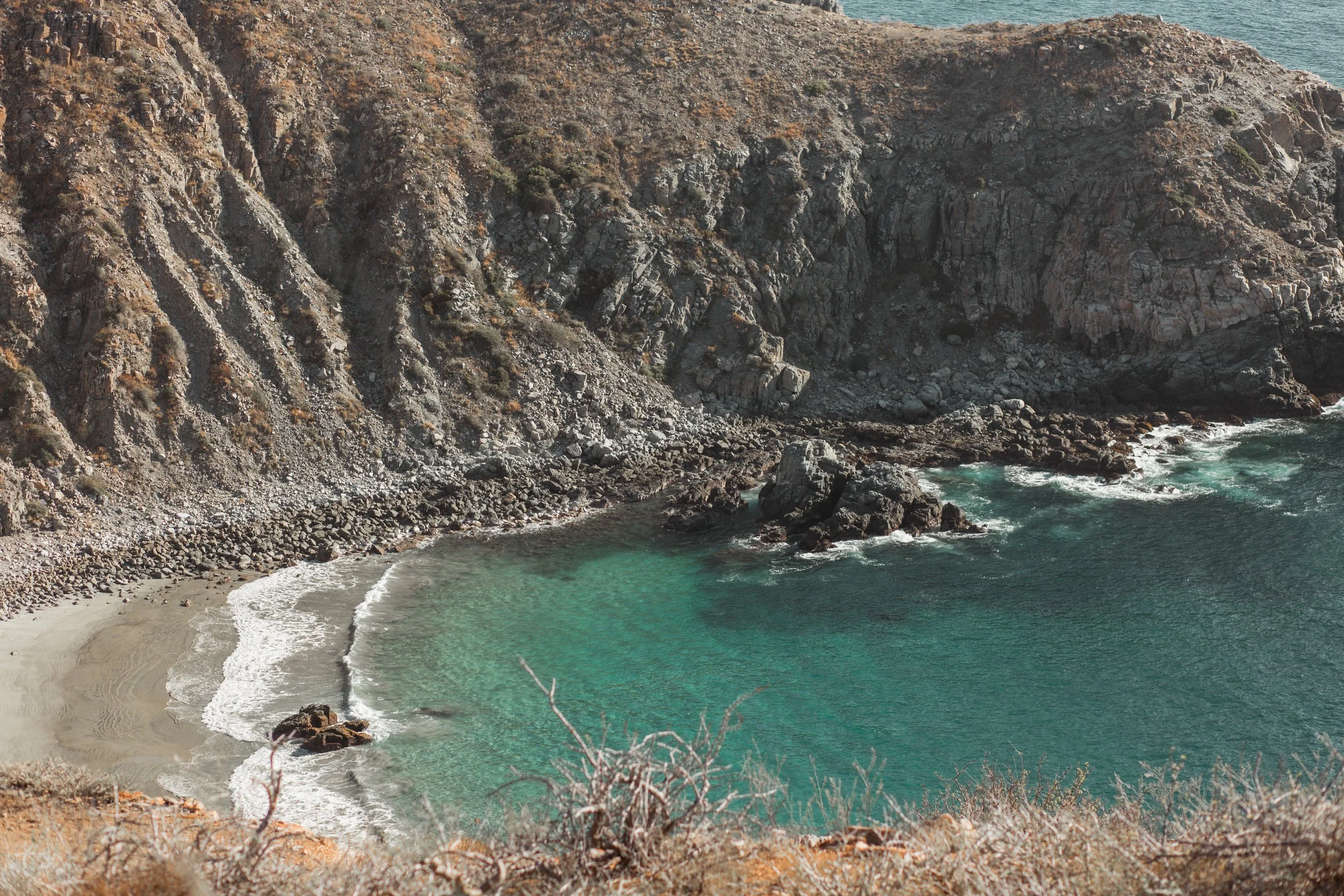
About an hour from Cabo San Lucas on the Pacific side, Punta Lobos is the beach where Todos Santos fishermen launch their pangas through the surf each morning. The trail starts behind the small yellow chapel at the beach and climbs steadily up the headland to a series of viewpoints over the Pacific, with the Sierra de la Laguna visible inland. The full route is about four miles out and back, moderate, and takes two to two and a half hours at a relaxed pace.
You can often spot sea lions resting on the rocks below the cliffs, which is where the point gets its name, and from December through April there’s a good chance of spotting gray whales offshore. On the far side of the headland, a steep, rocky path descends into a small cove holding the ruins of the old sugar port and cannery, worth the extra effort if your legs agree. The trail is free and unmarked but easy to follow. Some sections run close to exposed cliff edges, so keep kids and dogs close, and the midsection includes some rock scrambling, so do this one in full daylight. It’s well worth the drive though, because this is one of the most striking views you’ll find when hiking around Los Cabos.
The East Cape: Cabo Pulmo
Roughly two hours from Cabo San Lucas, the village of Cabo Pulmo sits beside a national marine park protecting one of the oldest coral reefs on the Pacific side of North America. The hills just north of the village hold a short loop trail with views over the park’s white sand beaches and the Sea of Cortez. Unlike most trails in the region, these are fairly well marked and in good condition. Pairing the hike with a morning of snorkeling in the park makes a full and worthwhile day, and the drive itself, partly on washboard dirt roads, is part of the experience.
The Sierra de la Laguna

The mountain range running up the spine of the peninsula is a protected biosphere reserve, with canyons, year-round streams, and pine and oak forest at the higher elevations. Day hikes and multi-day treks into the reserve, including the climb to Picacho de la Laguna, should be done with a guide: navigation is genuinely difficult, water sources vary by year, and conditions change after every storm season.
Guides based in Los Cabos, Todos Santos, La Paz, and the Santiago area run trips ranging from single-day canyon hikes to multi-day crossings. If you want the biggest hiking objective available in Baja California Sur, this is it.
Best Hiking Trails in La Paz
La Paz is about two hours from Los Cabos, and pairing one of these hikes with lunch on the malecón makes an easy full-day trip.

The Balandra Viewpoint Trail
Balandra Bay is often called the most beautiful beach in Mexico, and the viewpoint trail is the best way to see the whole bay at once. The route starts from a turnoff on the highway before the beach entrance and climbs over loose rock to two lookouts, with views across the shallow turquoise bay and the mushroom-shaped El Hongo rock formation. A communication tower near the top serves as a useful landmark for staying on route. Plan on one to two hours depending on pace.
Balandra is a protected area with limited daily entry to the beach itself, split into morning and afternoon windows, so if you want to swim after the hike, check the current entry schedule before you go.
Cerro de la Calavera
At the north end of the La Paz malecón, just past Marina Palmira, a hill full of natural rock arches and hollows rises above the bay. The arches sit just below the summit and are the main attraction, along with sunset views over the city and the Sea of Cortez. The most direct route goes straight up the south face on a loose, rocky path, and a gentler winding road comes down the back side, so most people go up the steep way and down the easy way. Trails here aren’t marked, so download a map, and since the hill is close to town, you can walk to the trailhead from the malecón.
Why We Love Living in Baja California Sur
This is a big part of why we love living in Baja California Sur. The abundance of outdoor activities is hard to overstate: within a couple of hours of home you can swim under a waterfall, soak in a natural hot spring, watch whales from a cliff, snorkel a living coral reef, and stand on a peak with the Pacific on one side and the Sea of Cortez on the other.
And with sunshine most days of the year and mild winters made for being outside, the weather rarely gets in the way of any of it.
The beaches and resorts may be what bring people to Los Cabos, but the trails, canyons, desert, and mountains are a big part of what makes them stay.
Happy hiking!